Showing posts with label TX. Show all posts

Friday, July 31, 2020

What does a workamper do all day anyway?

Soooooo, just so ya know, today is July 31st, and we have left the Refuge.  (Insert frowny face here, and yes, it was a bit more emotional than we/I had anticipated.)  But, since I hadn't really been keeping you up to date while we were ON the Refuge, I thought I would share a bit of what we were doing during the time of self-isolation and quarantine.  (Jennifer, please be patient, you've already seen most of these photos, but none of our friends have...)   Btw, let's all welcome our Volunteer Coordinator to the blog - hellloooo, Jennifer!  And Candice, too...our neighbor from Crystal River, FL, whom we miss dearly - howdy, Girlfriend, 'sup??!!  Ok, let's get back to work now...  So, the Refuge Visitor Center has been closed since mid or end of March (can't remember, and it really doesn't matter, it's been quite a while now), and the staff has mostly been working from home.  I say mostly, 'cuz if you're a fireman or maintenance specialist, it's darned near impossible to telecommute, and so they have been coming onsite to do their work.  However....their work does not include making things presentable and pretty, sooooo, that falls to the volunteers! The Russian Sage bush is way overgrown and the butterfly garden is full of weeds, so off to work we go! 


And here is the railing - all poopy and chipped, and just generally not pretty.  Since I have to use it to get up the steps, I wanted to spiff it up some.


And so, we waited till a Friday night, prepped it with our fancy recycled box spatter shields, and our spray painter extraordinaire got busy.

When all was said and done, it was shiny and looked brand new!


The next morning we trucked on over to Marble Falls, about 23 miles away (only 11, if you go by crow), and picked me up a hand pruner to make it easier for me to work in the flower bed.  That's the closest Lowes Home Improvement store, and the ACE Hardware that is in Lago Vista doesn't have a pruner worth a dime.  We know, 'cuz we bought the one they had, and pardon my French, but it sucked.  It got returned the day after it was purchased.  While we were at Lowes, we found a rack of scrawny, half-dead, dried up tomato plants.  For a dime each.  Ever searching for the perfect homegrown tomato (yes, STILL), Driver just couldn't resist.  We came home with two!  And a couple bags of compost and dirt.  There was a discarded pallet on the burn pile, so we salvaged that and turned it into a planter box.


And planted our 20 cent tomato plants.


Later that night, we still had some energy left, so we signed up for a Zoom square dance.  This would be our second one, so, thankfully, we were better than before.  We still had a time or two where we stepped out of camera range, and while muted, we had a discussion about where our phantom corners should have been.  Darn those phantoms, they could sure use a few lessons!  LOL, probably us, too, ya think?


Remember that Quilt of Valor I did a dedication block for?  If you don't just click on that there link, and you'll go right to the post that contains the original block.  I'll wait.  Well, apparently, it, and its quilt, turned out so well, the maker was tasked with recreating the whole thing for another Veteran.  In a month's time. So she sent me some more fabric, and as soon as it was received, I whipped out this little puppy.  I thought maybe we should change up the motif at the top, to more accurately reflect the land-based Army, rather than the ocean waves of the Navy, but she said the stars and scrolls were find, so who am I to argue.  Besides, I still had all the threads selected and readily available, so, BAM, plug in the new dude's name, and Save and stitch away.


The next day, or maybe another day, I don't really remember, but it was a working day, so it was Monday, Tuesday or Wednesday, we decided we were going to work on an area of the Refuge that was open to the public, but was about 15 miles from our campsite area.  To get there, we traveled down Cow Creek Road, and we got to see this beauty.  


and a baby....


So, you see here, there is a sign posted, suggesting that the area behind the sign was closed to the public.  No trails were here at Shin Oak Observation Deck.  This area is basically just a gazebo to shelter the crowds from the hot sun or sporadic rain showers that might pop up.  The area is dedicated to the Black Capped Vireo, a small and endangered songbird that nests exclusively in this area of central Texas. People come from all over the world to catch a glimpse of this shy little bird.  We never did see or hear one. 


But, we did fix it so that people would know to stay out of their territory.


While we were there, we got to see one of the Prickly Pear flowers up close and personal.  (Actually, Driver got REALLY up close and personal with one of the prickly parts, and it's a good thing I have tweezers.....)


This is how we found the boardwalk to the Observation Deck...


And this is how we left it...


This is how the parking lot looked when we arrived (you see all that trash around the edge??)...


And this is how it looked after we did our thing...


Back up at Warbler Vista, another area that is open to the public, we found another hidden sign....that we uncovered...


And, again, back at the Visitor Center, I couldn't wait to get my hands on the hedge trimmer to take care of these bushes around the foundation...


It was hard, strenuous work...


but so very rewarding in the end...


And, speaking of rewards...remember back when I was making all those masks, and I got a kit of 50 from our MagneShade friends?  I had agreed to sew them all up and return some or all back to them in North Carolina.  Well, the kit came, and I put out a Facebook notice to all our friends that I would have masks available in a week or so, and just let me know how many they needed of blue or pink.  John and Lora asked for 2 (I'm pretty sure I made them 2 each, but it's been so long, I just can't say for sure) to be sent to them at Happy Trails, in Arizona.  They offered to pay me for them, but, since this whole project was a charity thing, I didn't feel right accepting money for the masks or shipping.  I suggested they just buy lunch for a cop or a bag of dog/cat food for their local animal shelter.  Well, in typical Lora fashion, she told me that there would be a surprise waiting for me at the Marble Falls Post Office when we arrived here.  It.Never.Came.  First we went there (remember, it's not even close!), TWICE, and there was never anything there....and finally, we started calling.  And calling..and calling.  And there was never anything there for us.  Eventually, Lora ordered another surprise for us, and lo and behold, this one ARRIVED. And, boy, what a surprise it was!  While we were in Sedona, AZ, we had the pleasure of tasting freshly-squeezed Prickly Pear lemonade, remember?  I rather liked it, Driver was on the fence about it. (but if you pressed him, he would admit to liking it better than the mineral water lemonade of Mineral Springs, CO) Well, now I can make my OWN Prickly Pear lemonade!  Or, pour the syrup over pancakes.  Or make my PBJs with the jelly she so generously sent.  Oh my, what a prize this surprise was!  Thank you, thank you, thank you, Lora and John!!


So now you've seen a little of what we did the first couple of weeks we were on the Refuge.  There's much more to be done, so stay tuned!

Stay well and safe out there!

Tuesday, August 6, 2019

Palo Duro Canyon State Park

Warning - this post is long and picture-heavy, so if you're on limited bandwidth or close to your download limit, you might want to save this for later.

In separate conversations, Connie & Barbara S. both suggested that we make sure to visit Palo Duro Canyon sometime during our stay in Amarillo.  Soooo, we scoped it out, found out where it is, how much it costs, and what facilities and things to do were there.  It looked like we would be there a good while, so we suited up the puppy, packed the cooler with waters, charged up the batteries and hit the road.

Of course, flip flops are not the recommended foot attire for walking around trails in Texas, so we put on socks and sneakers too! This was to be Bailey's first real outing with her new booties.  She had "tried them on for size" when we first got them.  She seemed to adapt to them pretty well in Alabama, so we didn't think there would be much of an issue today.  And, to her credit, there wasn't.  Once she got them on, she was fine.  For a while, anyway....


On the way to the Canyon, we came across this field.  It's really hard to tell in this photo (we were traveling in the car, so we could drive the suggested 70 mph!  Sure makes taking photos a little more difficult though!), but this field must be several hundred acres.  And it was filled with nice, neat round hay bales.  Must have been thousands of 'em!  It was literally the most hay I've ever seen in one place, at one time, in my whole life!  I posted it on Facebook and Connie commented right away that her Grandparents' farm was in this very same area!  Small world, eh?

Here's another one of those mesmerizing windmills.  You can see how enormous they are in comparison to the itty bitty farm buildings!


With my back being so messed up, and us having the dog with us on such a blazing hot day, we knew we wouldn't be able to go far on any trail, so we decided we would geocache instead of hiking.  We're not the gluttons for punishment that Gail, Gary, Linda & Ron are, heehee.  We recorded the coordinates for about 12 caches, all close to a parking spot or the Park road, except for the first one.

The first geocache was actually just off the road, prior to the State Park entrance.  We parked on the shoulder of the road and Driver hoofed it about 200 feet, to the target area.  He looked and looked and looked.  I eased the car up a little closer, so that he wouldn't have to walk back so far and watched him continue to look for the cache.  The clue was "gold" and I thought I could see a gold flash in the tree, so I tried to direct him from across the street.  When it became apparent that I wasn't clear in my directions, I crossed over to help him look look for myself.  What I had thought was a gold flash, aka, the cache, was really only just the inner bark of a broken cedar branch.  Ha...I couldn't find it either!  The last time we went out, on Sunday, we were totally unsuccessful - we looked for 5 caches and found not a one!  Not a ONE!  That has never happened before, so we thought maybe the GPS needed calibration.   Well, the next day was moving day, as you know, so of course, we didn't do anything about it....fast forward to today...today was the day to calibrate the GPS.  Either that or we have totally lost our geosenses.  Or are just plain blind.  While Dick was working to get the GPS back on track, I crossed back over the street to read about the huge arrow sticking up out of the prairie grasses.  As we learned later in the day, this area was originally Comanche territory before they were all but wiped out by the White Man.  The artist Charles A Smith has taken it upon himself to forge a network of 23-foot-tall steel arrows and place them throughout Texas and the Southern Great Plains, marking the sites where the last of the Comanches, led by Quanah Parker, hunted, traded, lived, traveled and fought, in an effort to honor the Comanches' culture and heritage.  You can read more about the Chief, and discover the locations of the arrows, online, at www.QuanahParkerTrail.com.  


So, OK, we never did find that cache.  Not surprising, sometimes, they just really aren't there by the time we go seeking them.  No big deal, we have plenty more inside the park to find.  We travel another half mile, and all of a sudden, we are at the park entrance and the terrain has dramatically changed!  We've been looking at flat plains, that go on forever, for a couple of days, and now we're seeing a huge ditch!  We paid our admittance fee and promptly found the 2 geocaches that were located near the park entrance and Ranger Station, then followed Park Road 5 further into the Canyon.


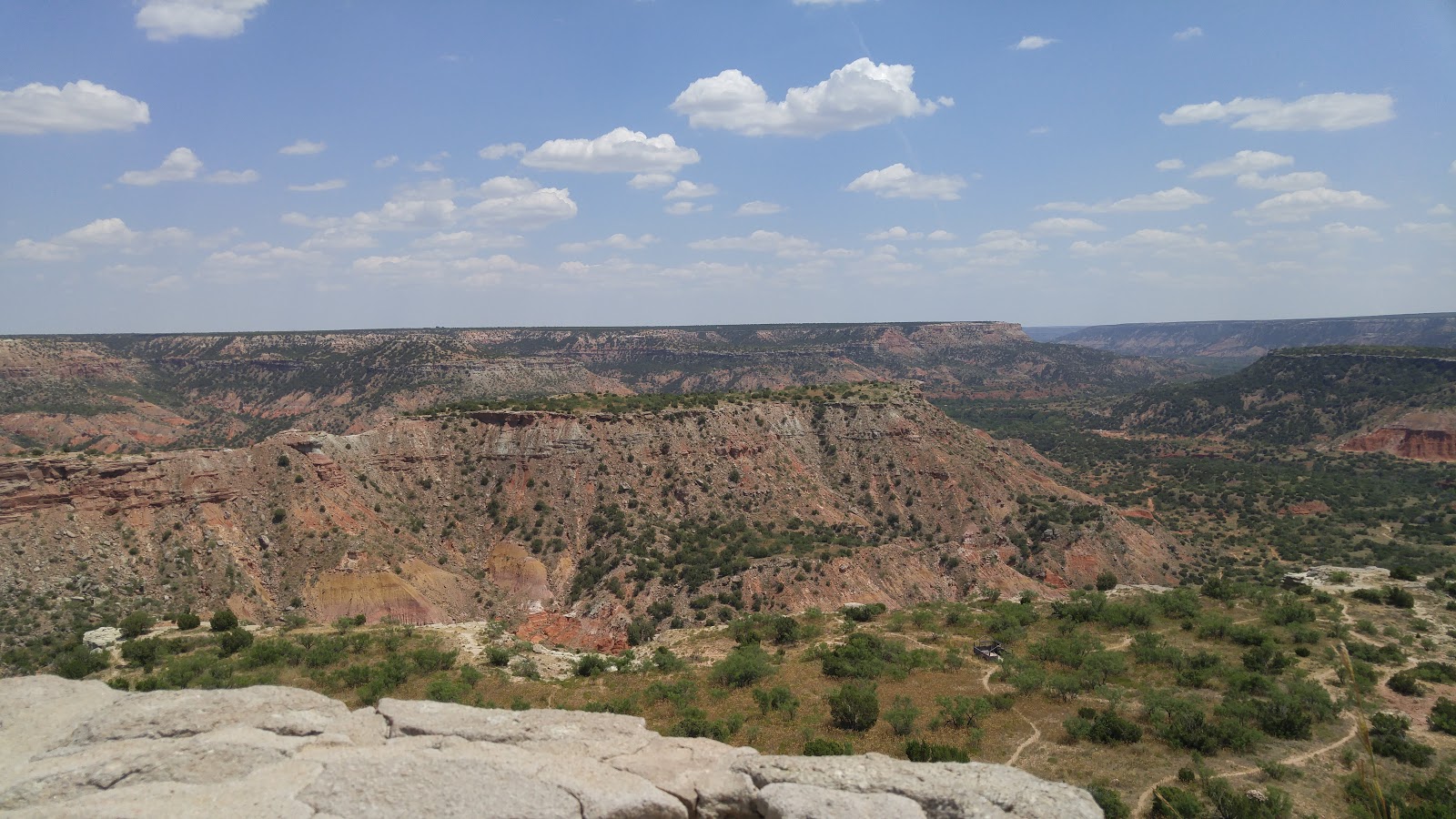
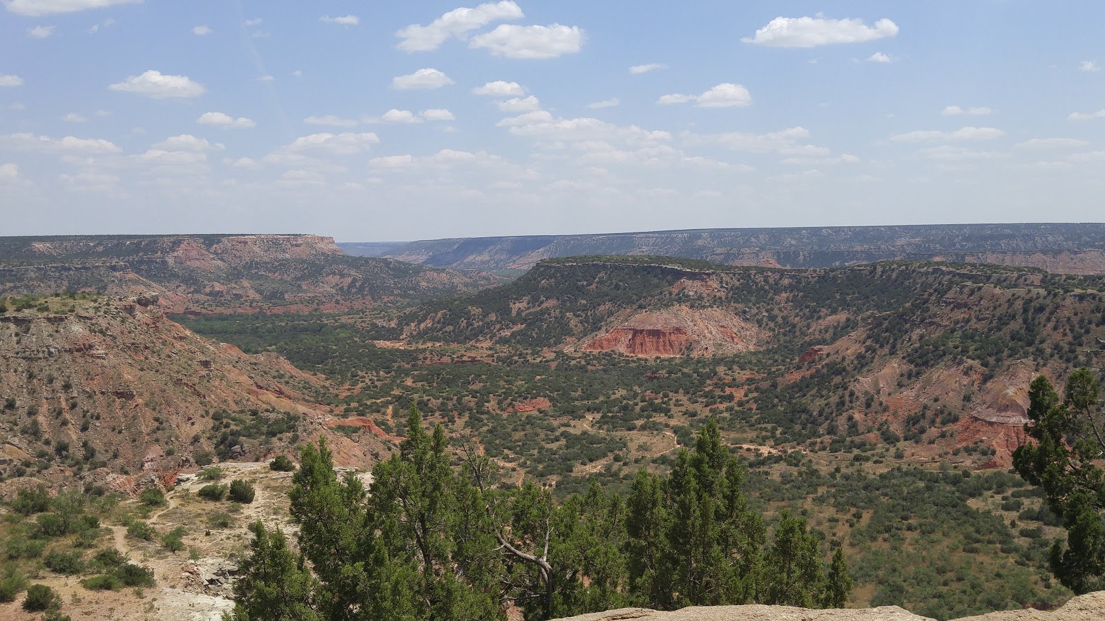
Here is a panoramci view, and the placques below indicate the names of the mesas in view and their distance from the overlook. 


I tried to match up my pictures with the placques, but it was really hard to see my camera screen, so, often, I really didn't know what I was taking a picture of!

Evidently, the Civilian Conservation Corp was a big part of the development of the Canyon, in the early 30's.  All of the Park's structures (cabins, concession areas, rest rooms, pillars and fences),and even the road, were constructed by the unemployed men and returning Veterans of the Depression era.  Why don't we do that today?  Everywhere we go, we see jobs available and businesses are crying out for help, yet our Welfare rolls are never-ending, and we have millions of eligible employees, sitting around, out of work, and collecting taxpayer funds.  I'm sorry, let me step down off my soapbox.  I'm not against Welfare for truly indigent and those unable to work.  I'm against Welfare rewarding children for procreating or doing drugs, making themselves un-employable and undependable.


This is the view out one of the large plate glass windows in the Visitor Center.

'
There was an extensive collection of pottery in the Visitor Center, and it was all for sale.  Lucky for our wallets, it doesn't mesh well with our coastal and flamingo decor.  We were able to admire it, but we left it all on the shelves.


There was a whole section dedicated to how the Canyon was formed:


And a whole room dedicated to the CCC workers:


I thought it was interesting to learn the roots of the saying, Another Day, Another Dollar.  Apparently, each worker was paid just that - one dollar for each day's work.  And it was HARD work, too.  I just can't imagine any of today's workforce working so hard for so little.


This photo gives you an idea of how high these canyon walls really are.  That's a line of men, building the road that winds through the park.  They look like little ants, don't they?!


There were placed I had to look away....


I truly fear heights and roller coasters, and this road was both!

I was relieved when we reached the bottom, about 400 feet lower than the rim, according to our GPS.


There are several areas dedicated to camping down inside the Canyon.  And there were SEVERAL campers already set up!  Even a few tenters!  You can make out a 5th wheel, barreling down the lower hill and a little travel trailer up on the higher level.  As we drove through the campground areas, Dick kept pointing out various sites that would fit our motorcoach.  Ummmm....I had to wonder if he had simply lost his mind for good this time.  There's absolutely no chance, in this world, or any other, that I would allow him to drive our camper on those narrow & twisty roads.  NoWAY!!  And yet, there he would go, pointing out another one!  Nooooo, babe, NOOOOO!  Just.Plain.N.O!


Some of the rocks looked like they would tumble in a strong wind...


At the gift store, we even found the perfect T-shirt for Gail, for when she loses the shirt off her back.  I should send it to her son, so he can present it at the heart-to-heart he holds for her. HAHAHA, that would be funny, wouldn't it??


And, of course, we all took a break in the air conditioning, while Driver chowed down on his butter pecan.  We didn't mind waiting at all!  :)


We didn't lose sight of our objective, though; we were there to find geocaches along the way.  This would be standard search posture.  Because it was so very hot, we took turns seeking out each cache.  One person went out with the GPS and whatever clues were available, while the other stayed in the car, keeping the A/C running for the pup.  


 At one point, we passed a directional sign for the Lighthouse Trail, pointing to a small, dusty clearing that passed for a parking area.  We hadn't seen or heard anything about a Lighthouse, but our interest was piqued, so up we went!  It was kind of like spotting a Yard Sale sign on Friday morning!  You knew it would be good, right?  So, you can imagine our disappointment when we read that it was a 6 mile trek, round trip. And a gallon of water per person was recommended.  But, you see that last line?  Do not attempt if you have medical problems.  Well.  That sure disqualified me, right off the bat!  (whew, what a relief!!  I mean, not like I wanted to hike 6 miles, ya know?  Not this week.  Probably not next, either, so don't even go there...)


Pictures don't lie.  I believe this is some of the hottest temps we've ever experienced when we were out and about.  We've had high temps like this before, but we have always been inside or non-active at that time.


 So I walked a few feet down the trail, which was really UP the hill, and I came upon this formation.  Personally, I thought it looked more like a women's body part than a lighthouse, but, what the heck, maybe there had been some erosion.  I walked back to the car, and found Driver studying a kiosk off to the side of the trail.


And, wouldja look at that?  A photo postcard of the actual Lighthouse formation.  Looked more like a lighthouse than what I had seen...

 And, old Eagle Eye himself, found the true formation and pointed it out to me....we just had to walk a bit more than a few steps up the hill.


There were about 6 "water crossings" marked on the map.  Every single one of them had a flood stage marker such as this.  And there was one on each side of each bridge.  I an only imagine the quantity of water that it would take to make the little creek flood to this degree.


Lolly, this one is for you and Allen:


And this is the current status of the creek, looking northward at water crossing number 6.  Dry as a dusty old bone!


And looking Southward, still dry and dusty.  Not a drop of water.


I found this description of one of the final battles between the Indians and White Men is truly disturbing because of the atrocity of it all.


I took this photo because, when we were up at the other end of the canyon, on the rim, Dick had thought there were some cliff dwelling off in the distance.  I'm pretty sure this is what we were looking at.  And maybe they are dwellings for someone....like a bear of some foxes?  This is a zoomed in picture; we were pretty far off, and in no mood (or shape!) to go check for occupants!


And now, we have full bellies, been walked and showered, dishes and laundry are done, and we are all too pooped to pop!


'Till next time!